The relevant media releases about the land additions to the Conservation Park:
Department for Environment and Water – More recreational…
I’ve reproduced the media release from the Premier’s office below:

The relevant media releases about the land additions to the Conservation Park:
Department for Environment and Water – More recreational…
I’ve reproduced the media release from the Premier’s office below:
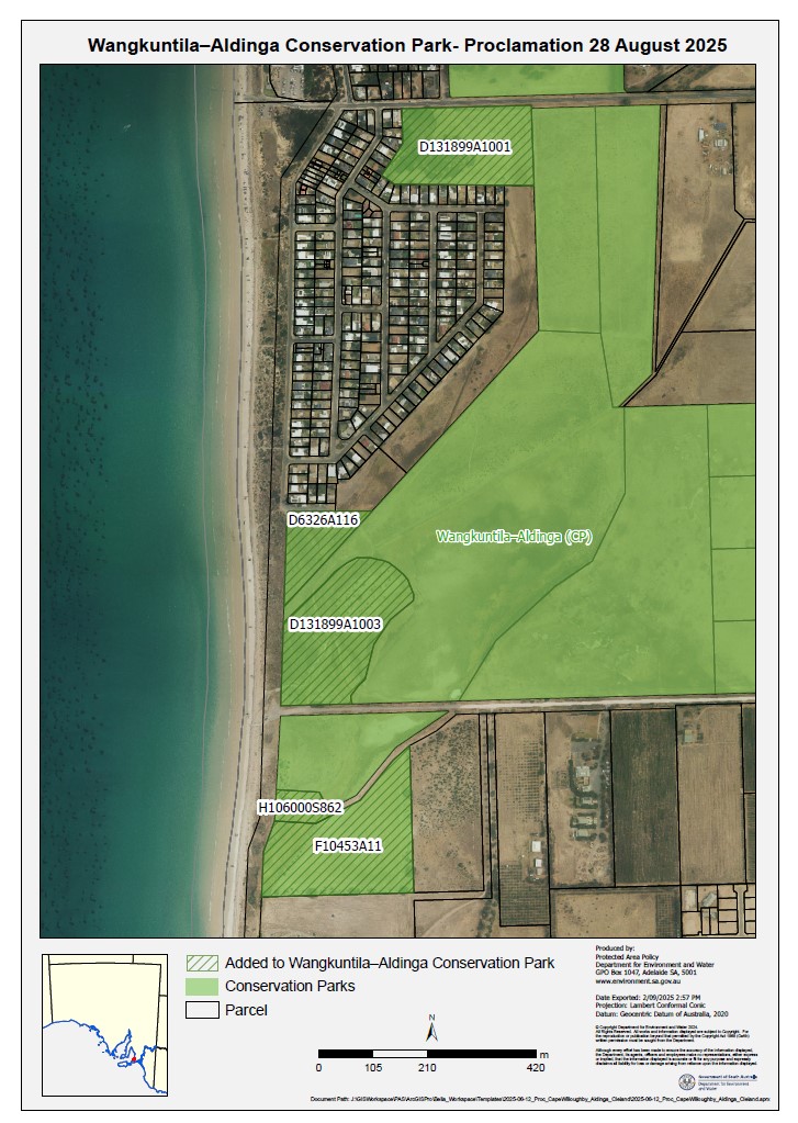
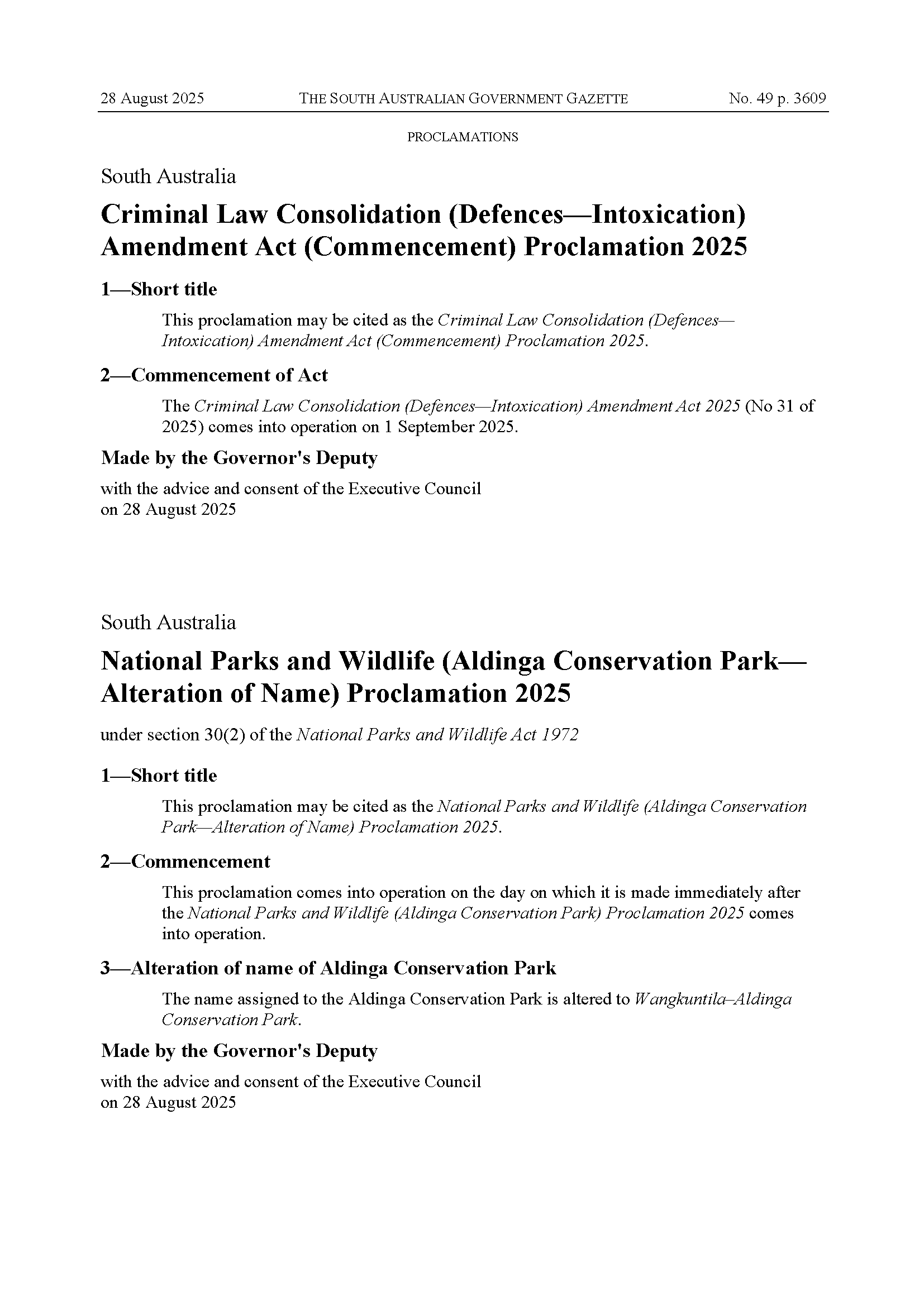
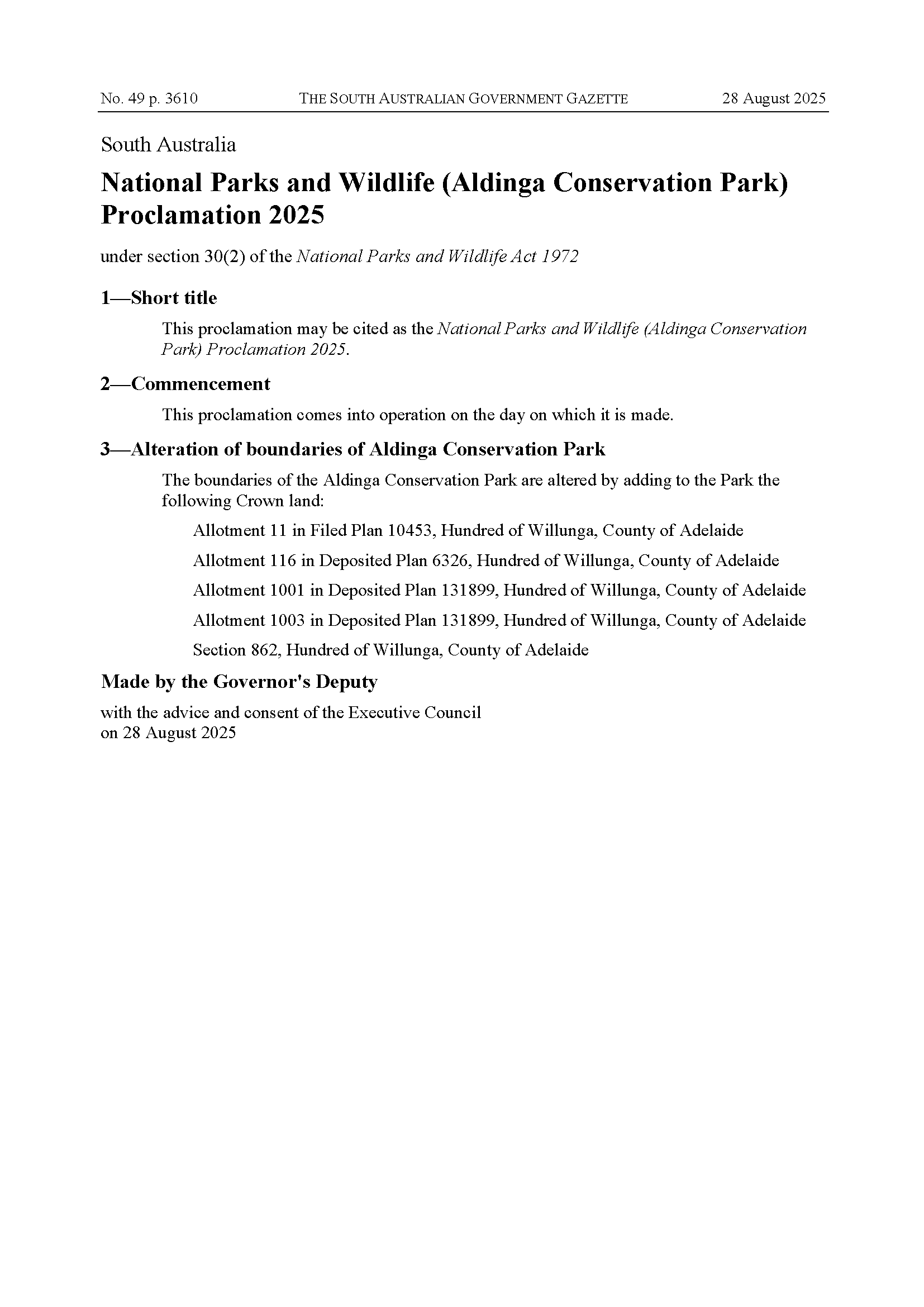
Exciting to see most of the remaining land parcels finally being added into the Aldinga Conservation Park. The Park also has a new name – Wangkuntila–Aldinga Conservation Park. The parcels adjacent to the Silver Sands housing area have stormwater complications – it remains to be seen whether these will be resolved and these parcels also added.
Gazette proclamations below (ignore the Criminal Law proclamation), as well as the updated park map (hatched areas are the new additions – the Blue Lagoon site is in the northwest):
Sourced from: https://www.mediastatements.wa.gov.au/Pages/McGowan/2022/11/Community-invited-to-comment-on-sandalwood-management.aspx
Western Australians can now have their say on the conservation and use of sandalwood over the next five years.
The draft Sandalwood Biodiversity Management Programme aims to stabilise wild sandalwood and outlines how it can be sustained into the future.
Sandalwood (Santalum spicatum) is a slow-growing tree found across 146 million hectares of the Wheatbelt, Goldfields, Murchison, Gascoyne and southern Pilbara. Extensive agricultural clearing has seen wild sandalwood dwindle over the past 200 years, particularly in the Wheatbelt. It’s also been impacted by illegal harvesting, pests, grazing and bushfires.
The draft programme prepared by the Department of Biodiversity, Conservation and Attractions sets out how wild sandalwood will be conserved, protected and managed, consistent with the requirements of the Biodiversity Conservation Act 2016. It will not apply to plantation sandalwood.
The public comment period is open until 9 December. To have your say, visit http://www.dbca.wa.gov.au/sandalwood
Comments attributed to Environment Minister Reece Whitby:
“Sandalwood is a unique resource and we’re committed to protecting and sustaining this remarkable species for generations to come.
“This will apply to the management of wild sandalwood on both Crown and private land, but won’t apply to plantation sandalwood.
“Having your say will help us understand any industry or community concerns to help shape the management of this important native species.”
Draft Sustainability Strategy now available: https://www.adelaide.edu.au/sustainability/hereforgood
The headline targets from the Strategy reproduced below; note that they have chosen net zero carbon emissions by 2025, and carbon neutral by 2030 (carbon neutral means “The University’s scope 1, 2 and 3 emissions are balanced via removal of equal greenhouse gas emissions from the atmosphere as per the Climate Active standard.“)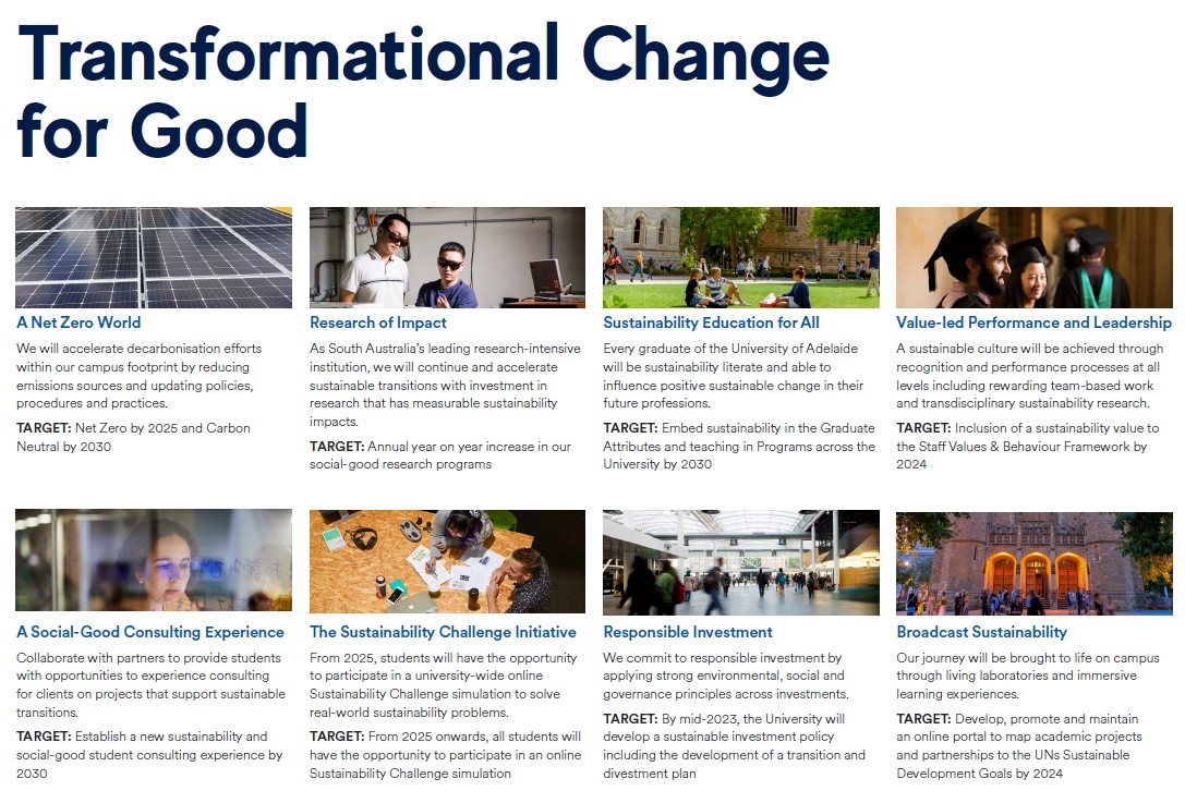
Good Evening Michael,
Apologies for the length of time it’s taken to get back to you.
Since we last exchanged emails on this topic we have discovered there is a bit more to this issue than we originally thought. We’ve engaged with the DEW Parks Marketing team to get a better understanding of the information that the department already provides to Google – this has helped to define the scope of what we need to consider. Here is a summary of what we have uncovered.
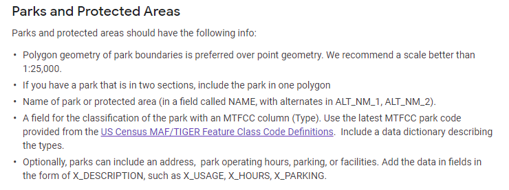
Information Discovery
o park name
o park address
o contact phone number
o opening times
o web link to DEW Parks web site – eg Belair National… – National Parks and Wildlife Service South Australia
o an (XY) map coordinate to define the centroid for the park – for Google functions like display, zoom and obtaining directions
Considerations
o For example, the use of park type abbreviations in the park name in our mapping layer is likely to be different to that required for public use, as currently delivered through the Business Profile account – some reformatting of park information will be required
Related Issue
Next Steps
We’re currently looking to arrange a conversation with a Google contact so that we can discuss these issues and hopefully identify options for providing the required information (for both Parks Business and Mapping) in a coordinated approach – ideally without the need for overlapping accounts.
Thanks for your patience whilst we work through these issues.
Kind Regards, Online Mapping Support
DEW Online Mapping
Department for Environment and Water
GPO Box 1047, Adelaide, SA 5001
environment.sa.gov.au