Good Evening Michael,
Apologies for the length of time it’s taken to get back to you.
Since we last exchanged emails on this topic we have discovered there is a bit more to this issue than we originally thought. We’ve engaged with the DEW Parks Marketing team to get a better understanding of the information that the department already provides to Google – this has helped to define the scope of what we need to consider. Here is a summary of what we have uncovered.
Information Discovery
- The department is already providing information to Google for high visitation parks through a Google Business Profile account.
- The information provided includes:
o park name
o park address
o contact phone number
o opening times
o web link to DEW Parks web site – eg Belair National… – National Parks and Wildlife Service South Australia
o an (XY) map coordinate to define the centroid for the park – for Google functions like display, zoom and obtaining directions
- This is an example of the information for Belair National Park – Belair National park – Google Search
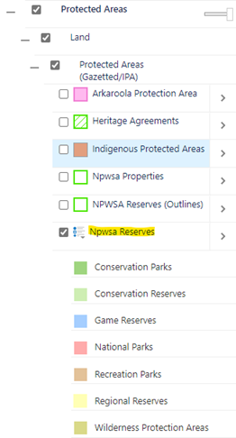
- An additional Google Map Content Partner account would be required to upload mapping data representing park boundaries to Google for inclusion on Google map products
Considerations
- The Google Business Profile and Map Content Partner accounts are not the same – we are not able to use the existing departmental Business Profile account to upload mapping data.
- There is an overlap in the park information that can be provided to Google by each account – this means there is a potential to provide conflicting information for a park, unless there is careful curation of park information content.
o For example, the use of park type abbreviations in the park name in our mapping layer is likely to be different to that required for public use, as currently delivered through the Business Profile account – some reformatting of park information will be required
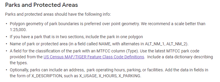
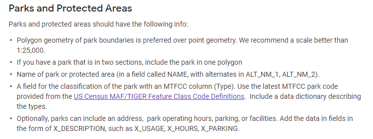
- As mentioned in our previous email, Google has published some guidelines defining the required format and structure of mapping data to be provided by a Map Content Partner account – Geo Data Upload Content Requirements – Map Content Partners Help (google.com). For mapping data representing Parks and Protected Areas, our park mapping data will need to be translated to meet the guidelines below. This will require an automated (scripted) translation process if were are to provide parks mapping data to Google on a regular basis.
Related Issue
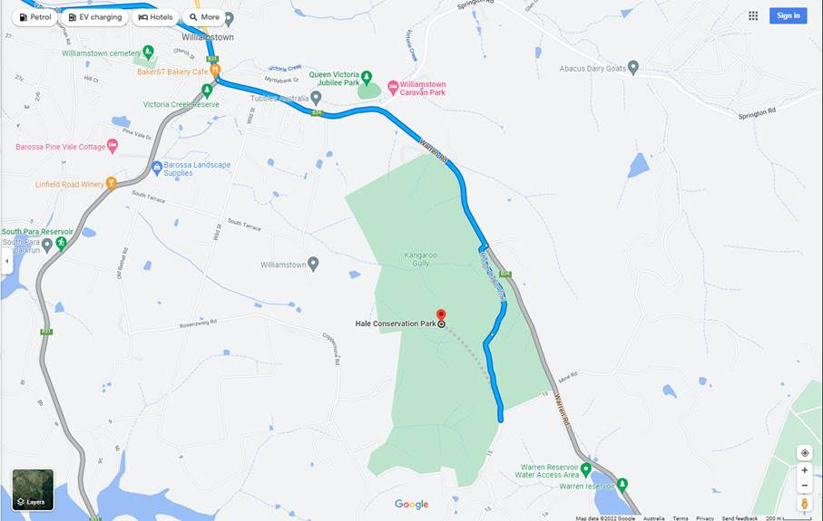
- We’ve also been informed of a related issue – there is a need to provide map coordinates to identify the main entrance / public access points for a park. This is to help provide more accurate directions in Google maps.
- At the moment the directions function in Google does not always guide visitors to the most logical access point for a park – see example below
- In some cases this will require verification with regional parks staff to ensure we are providing up-to-date access information.
Next Steps
We’re currently looking to arrange a conversation with a Google contact so that we can discuss these issues and hopefully identify options for providing the required information (for both Parks Business and Mapping) in a coordinated approach – ideally without the need for overlapping accounts.
Thanks for your patience whilst we work through these issues.
Kind Regards, Online Mapping Support
DEW Online Mapping
Department for Environment and Water
GPO Box 1047, Adelaide, SA 5001
environment.sa.gov.au


